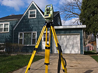
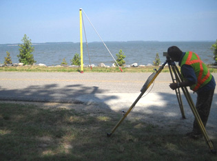
Types of Surveys
The following is an excerpt from the FLORIDA ADMINISTRATIVE CODE – Chapter 5J-17.050
(10) Survey: the orderly process of determining facts of size, shape, identity, geodetic location, or
legal location by viewing and applying direct measurement of features on or near the earth’s surface using field
or image methods; defined as follows according to the type of data obtained, the methods used, and the
purpose(s) to be served:
(a) As-Built Survey: a survey performed to obtain horizontal and/or vertical dimensional data so that
constructed improvements may be located and delineated; also known as a Record Survey.
(b) Boundary Survey: a survey, the primary purpose of which is to document the perimeters, or any one of
them, of a parcel or tract of land by establishing or re-establishing corners, monuments, and boundary lines for
the purposes of describing the parcel, locating fixed improvements on the parcel, dividing the parcel, or
platting.
(c) Condominium Survey: a survey performed pursuant to Chapter 718, F.S.; includes a Boundary Survey.
(d) Construction Layout Survey: the measurements made, prior to or while construction is in progress, to
control elevation, configuration, and horizontal position and dimensions.
(e) Control Survey: a survey which provides horizontal or vertical position data for the support or
control of subordinate surveys or for mapping.
(f) Hydrographic Survey: a survey having as its principal purpose the determination of data relating to
bodies of water, and which may consist of the determination of one or several of the following classes of data:
depth of water and configuration of bottom; directions and force of current; heights and times of water stages;
and location of fixed objects for survey and navigation purposes.
(g) Mean High Water Line Survey: a survey to document the mean high water line as defined in Chapter 177,
Part II, F.S.
(h) Quantity Survey: a survey to obtain measurements of quantity.
(i) Record Survey: a survey performed to obtain horizontal and/or vertical dimensional data so that
constructed improvements may be located and delineated; also known as an As-Built Survey.
(j) Specific or Special Purpose Survey: a survey performed for a purpose other than the purposes detailed
in paragraphs (10)(a)-(i) or (k) of this rule.
(k) Topographic Survey: a survey of selected natural and artificial features of a part of the earth’s
surface to determine horizontal and vertical spatial relations.
Additionally, per an excerpt from Chaper 5J-17.051 regarding Standards of Practice
(3)(b):
1. Each survey map and report shall state the type of survey it depicts consistent with the types of surveys
defined in paragraphs 5J-17.050(10)(a)-(k), F.A.C. The purpose of a survey, as set out in paragraphs
5J-17.050(10)(a)-(k), F.A.C., dictates the type of survey to be performed and depicted, and a licensee may not
avoid the minimum standards required by rule of a particular survey type merely by changing the name of the
survey type to conform with what standards or lack of them the licensee chooses to follow.
Minimum Technical Standards
FLORIDA ADMINISTRATIVE CODE – Chapter 5J-17.052 Standards of Practice:
(1) As-Built/Record Survey:
(a) When performing as-built or record surveys, the surveyor and mapper shall obtain field measurements of
vertical or horizontal dimensions of constructed improvements so that the constructed facility can be
delineated
in such a way that the location of the construction may be compared with the construction plans.
(b) When the surveyor and mapper prepare as-built maps they will clearly show by symbols, notations, or
delineations, those constructed improvements located by the survey.
(c) All maps prepared shall meet applicable Standards of Practice.
(d) The vertical and horizontal accuracy of the measurements made shall be such that it may be determined
whether
the improvements were constructed consistent with planned locations.
(2) Boundary Survey, Map, and Report:
(a) Boundaries of Real Property:
1. The surveyor and mapper shall make a determination of the position of the boundary of real property in
complete accord with the real property description shown on or attached to the survey map or report.
2. All boundary surveys shall result in a map.
3. Any discrepancies between the survey map and the real property description must be shown.
4. All changes in direction, including curves, shall be shown on the survey map by angles, bearings or
azimuths,
and will be in the same form as the description or other recorded document referenced on the map.
5. Curved lines with circular curves shall show the radii, arc distances and central angles, or radii, arc
distances, chord distances and chord bearings.
6. When intersecting lines are non-radial to a curve, sufficient angular data shall be shown to relate the
line
to the curve.
7. Surveys of all or part of a lot(s) which is part of a recorded subdivision shall show the following upon
the
map:
a. The lot(s) and block numbers or other designations, including those of adjoining lots.
b. A comparison between recorded directions and distances with field measured directions and distances when
they
vary.
c. A comparison between the recorded directions and distances with field measured directions and distances to
the
nearest street intersection, right of way intersection or other identifiable reference point.
d. The dimensioned remaining portion of a lot(s) when part of a lot is included within the description.
8. Surveys of parcels described by metes and bounds shall show the following upon the map:
a. The relationship of the parcel(s) to at least one established identifiable real property corner;
b. All information called for in the property description, such as point of commencement, course bearings and
distances, and point of beginning;
c. A comparison between recorded directions and distances and field measured directions and distances on the
boundary when they vary;
d. The most current abutting recorded instrument or recorded plat either known by the surveyor and mapper or
furnished to the surveyor and mapper.
(b) Boundary Monuments:
1. The surveyor and mapper shall set monuments as defined herein, unless monuments already exist or cannot be
set
due to physical obstructions at such corners or unless a water boundary has been located in approximate
position. The survey map shall clearly label all approximate water boundaries with notes and these shall be
mapped in a distinctly different graphic fashion from water boundaries located to full survey accuracy.
2. Every boundary monument set shall:
a. Be composed of a durable material;
b. Have a minimal length of 18 inches;
c. Have a minimum cross-section area of material of 0.2 square inches;
d. Be identified with a durable marker or cap bearing either the Florida license number of the surveyor and
mapper in responsible charge, the certificate of authorization number of the business entity; or name of the
business entity;
e. Be detectable with conventional instruments for finding ferrous or magnetic objects.
f. When a corner falls in a hard surface such as asphalt or concrete, alternate monumentation may be used
that is
durable and identifiable.
3. All monuments, found or placed, must be described on the survey map. The corner descriptions shall state
the
size, material, and cap identification of the monument as well as whether the monument was found or set.
4. When a parcel has an irregular roadway as a boundary, such as a dirt road or a common law road, then a
monumented meander or survey line shall be established along or near the feature.
5. For other irregular boundaries such as a river, lake, beach, marsh or stream, not identified as in
subparagraph 5J-17.052(2)(a)1., F.A.C., a dimensioned meander or survey line may be used. When a meander or
survey line is used, monuments shall be set at the meander or survey line’s terminus points on real property
boundary lines and dimensions shall be shown between a meander or survey line and the boundary line
sufficient
to show the relationship between the two.
6. A boundary survey updating a previous survey made by the same surveyor and mapper or business entity, and
which is performed for the purpose of locating non-completed new improvements by measurements to the
property
lines or related offset lines placed on the property since the previous survey, need not have the property
corners reset.
7. Side ties to locate or set monuments shall be substantiated by a redundancy of measurements.
(c) Boundary Inconsistencies:
1. Potential boundary inconsistencies that the survey process did not attempt to detect shall be clearly
indicated and explained on the survey map or in the report. Where evidence of inconsistency is found, the
nature
of the inconsistency shall be shown upon the survey map, such as:
a. Overlapping descriptions or hiatuses;
b. Excess or deficiency;
c. Conflicting boundary lines or monuments; or
d. Doubt as to the location on the ground of survey lines or property rights.
2. Open and notorious evidence of boundary lines, such as fences, walls, buildings, monuments or otherwise,
shall
be shown upon the map, together with dimensions sufficient to show their relationship to the boundary
line(s).
3. All apparent physical use onto or from adjoining property must be indicated, with the extent of such use
shown
or noted upon the map.
4. In all cases where foundations may violate deed or easement lines and are beneath the surface, failure to
determine their location shall be noted upon the map or report.
(d) Rights-of-Way, Easements, and Other Real Property Concerns:
1. All recorded public and private rights-of-way shown on applicable recorded plats adjoining or across the
land
being surveyed shall be located and shown upon the map.
2. Easements shown on applicable record plats or open and notorious evidence of easements or rights-of-way on
or
across the land being surveyed shall be located and shown upon the map.
3. When streets or street rights-of-way abutting the land surveyed are physically closed to travel, a note to
this effect shall be shown upon the map.
4. When location of easements or rights-of-way of record, other than those on record plats, is required, this
information must be furnished to the surveyor and mapper.
5. Human cemeteries and burial grounds located within the premises shall be located and shown upon the map
when
open and notorious, or when knowledge of their existence and location is furnished to the surveyor and
mapper.
(e) Real Property Improvements:
1. Location of fixed improvements pertinent to the survey shall be graphically shown upon the map and their
positions shall be dimensioned in reference to the boundaries, either directly or by offset lines.
2. When fixed improvements are not located or do not exist, a note to this effect shall be shown upon the
map.
3. Building corners are acceptable as monumentation so long as use of building corners as monumentation is
clearly noted on survey drawing.
4. When a boundary survey updating a previous boundary survey is made by the same surveyor or survey firm for
purpose of locating non-completed new improvements, then property corners need not be reset; however, when a
boundary survey is updating a previous survey made by the same surveyor or survey firm and is performed for
purpose of locating completed new improvements then property corners must be recovered or reset. When a
boundary
survey updates a previous boundary survey made by a different surveyor or survey firm for the purpose of
locating either non-completed or completed new improvements, then property corners must be recovered or
reset.
(3) Construction Layout Survey:
(a) When the surveyor and mapper provides construction staking, these stakes must be based on controls
established using the survey standards set out in Rules 5J-17.051 and 5J-17.052, F.A.C., of this chapter.
The
stakes provided should be adequate in number and position so that the physical items can be constructed from
the
plans as designed.
(b) Horizontal and Vertical Controls for Public and Private Construction Layout:
1. Section 472.003(3), F.S., provides an exemption from licensing for certain classes of individuals
performing
construction layout from boundary, horizontal and vertical controls that have been established by a licensed
professional surveyor and mapper. This rule is designed to set out what constitutes horizontal and vertical
controls.
a. Horizontal control monumentation for the purpose of this rule includes:
(I) Points of Curve, Points of Tangency, Points of Tangent Intersections, Points on Line and Points on
Curve.
(II) Points of Intersection of other streets or roads.
(III) Angle points or changes in direction.
b. Horizontal control monumentation for road center-lines, right-of-way lines, reference lines or base lines
shall be at least a minimum of two (2) points placed so that no point on the line being monumented is more
than
700 feet from a control monument.
c. Horizontal control monumentation for main utility lines (such as water, sewer, storm drainage, electric,
telephone, television, gas, etc.) when not constructed within or along a road right-of-way control in
accordance
with sub-subparagraph 5J-17.052(3)(b)1.b., F.A.C., shall be at least a minimum of two (2) points placed so
that
no point on the line being monumented is more than 700 feet from a control monument.
d. Horizontal control monumentation for buildings and/or primary constructions shall be at least:
(I) Boundaries, or
(II) Control or base lines (minimum of 2 points), or
(III) A minimum of a four-corner envelope for non-residential construction improvement layout.
e. Horizontal control monumentation required by plans as a control for horizontal location not included in
sub-sub-subparagraphs 5J-17.052(3)(b)1.b., c., or d., F.A.C., shall meet the requirements of subparagraph
5J-17.052(3)(b)2., F.A.C.
(c) All construction requiring benchmarks shall have a minimum of two (2) existent or established benchmarks
for
vertical control.
(d) Vertical control for linear type construction sites such as roads and sewer lines shall have a maximum of
1,100' feet between existent or established benchmarks.
(e) Vertical control for acreage construction sites shall have two (2) existent or established benchmarks on
the
first ten (10) acres plus an additional benchmark for each additional ten (10) acres.
(f) The only required documentation for this type of survey product shall be field notes.
(4) Control Survey:
(a) Geodetic Control Surveys: When applicable, all geodetic control surveys, both vertical and horizontal,
shall
conform to the Standards and Specifications for Geodetic Control Networks (1984) as set forth by the Federal
Geodetic Control Committee (FGCC), which Standards and Specifications are incorporated herein by reference,
effective 5-13-96, and the Geospatial Positioning Accuracy Standards Parts 1, 2, and 3, FGDC-STD-007.1-1998,
entitled “Geospatial Positioning Accuracy Standards Part 2: Standards for Geodetic Networks”, and
FGDC-STD-007.3-1998, entitled “Geospatial Positioning Accuracy Standards Part 3: National Standard for
Spatial
Data Accuracy”, which are hereby incorporated by reference, effective 5-18-00, copies of which may be
obtained
via the internet web site (http://fgdc.gov/standards_publications/). No use of the terminology of these
standards may be made without completely adopting and following all the standards in their entirety. When
these
standards are not employed, then a survey, map, or report shall explain applicable standards used in the
geodetic control survey. All geodetic control survey maps or reports shall show the horizontal and vertical
datum used and shall contain adequate graphical or written descriptions of the locations, construction and
marking of all marks used or set and shall explain methods employed in the survey and adjustment.
(b) Other Control Surveys: Any control survey map or report shall detail the datum used and control stations
used
in a manner consistent with the general survey and map provisions of subsection 5J-17.051, F.A.C.
(5) Descriptions/Sketch to Accompany Description:
(a) Descriptions written by a surveyor and mapper to describe land boundaries by metes and bounds shall
provide
definitive identification of boundary lines.
(b) When a sketch accompanies the property description, it shall show all information referenced in the
description and shall state that such sketch is not a survey. The initial point in the description shall be
tied
to either a government corner, a recorded corner, or some other well-established survey point.
(6) Digital Data:
(a) When survey information is provided in digital form only, the surveyor and mapper shall provide a signed
and
sealed report as set forth in sub-subparagraph 5J-17.051(3)(b)14.b., F.A.C.
(b) The digital file will reference the report and that the digital file is not full and complete without the
report.
(7) Ortho-Images/Photos:
(a) The survey, map, and/or report must contain a list of control points employed in geo-referencing the
image
along with the source of control positions used.
(b) Positional Accuracy: Feature accuracies shall be stated.
(c) The Ortho-Image/Photo shall comply with the December 1996 US Department of the Interior, US Geological
Survey
National Mapping Divisions, “National Mapping Program Technical Instructions Part 2 Specifications Standards
for
Digital Orthophotos,” which are incorporated herein by reference.
(8) Quantity Survey:
The surveyor and mapper shall obtain horizontal and vertical measurements adequate to delineate graphically
geometric configurations and/or dimensions that can be mathematically computed.
(9) Raster Imagery:
(a) The survey and report must contain a list of control points employed in geo-referencing the image along
with
the source of control positions used. The survey and report must contain a statement clearly stating that
“This
is not an ortho-image or ortho-photo.”
(b) Feature accuracies shall be stated.
(10) Subdivision Record Plat:
This rule shall not apply to plats being prepared for filing and recording pursuant to Chapter 177, F.S.;
however, this rule shall apply to any boundary survey performed during the preparation of the plat.
(11) Specific Purpose Survey:
(a) Surveys which are performed for a purpose other than the purposes encompassed by the definitions in
paragraphs 5J-17.050(10)(a)-(i) or (k), F.A.C., shall be permitted only where unusual conditions make
impracticable or impossible the performance of one of the types of surveys defined in paragraphs
5J-17.050(10)(a)-(i) or (k), F.A.C.
(b) Such purpose and conditions shall be clearly shown upon the survey map or in the survey report.
(c) Surveys performed for purposes of monumenting, referencing, describing, and mapping centerline or
baseline
may be performed as Specific Purpose Surveys. Additionally, surveys performed for the purpose of monumenting
official right-of-way lines may be performed as Specific Purpose Surveys.
(12) Topographic Survey:
(a) Topographic surveying and mapping by field methods shall meet general provisions applicable to all
surveys
and
maps as set out in Rule 5J-17.051, F.A.C. A minimum of two site benchmarks on or near the survey shall be
indicated
upon the survey map.
(b) Topographic Features.
1. Intended Features. The surveyor and mapper shall devise a method of reporting which topographic features
were
intended to be surveyed and mapped, the style of cartographic representation employed for each, and the
degree
of
intended completeness in the surveying and mapping of each feature. As with abbreviations, any symbols, line
types,
etc. shown on the survey map shall be explained and/or defined in a legend.
2. Obscured Areas. Features in obscured areas where the desired points or surfaces being mapped are not
clearly
visible on source images shall be clearly labeled on the map as “interpolated” or “estimated” through the
use of
notes and shall be depicted graphically clearly different from other surveyed features.
3. Scale of Map. The scale of the map that is selected when provided in hard copy shall be sufficient to
accurately
and clearly show the results of the survey.
4. Property Lines. Any depiction of property lines on a topographic map shall be accompanied with a statement
as
to
the source of the property lines shown.
Rulemaking Authority 472.008, 472.027 FS. Law Implemented 472.027 FS. History–New 9-1-81, Formerly 21HH-6.04,
Amended
12-18-88, Formerly 21HH-6.004, Amended 12-25-95, 5-13-96, 5-25-99, 4-4-06, 8-31-06, 8-18-08, Formerly
61G17-6.004,
Amended 5-11-15.
5J-17.053 Standards of Practice – Professional Matters in Surveying and Mapping.
In order to safeguard the health, safety and welfare of the public and to maintain integrity and high
standards
of
skill and practice in the surveying and mapping profession, the rules of professional conduct provided in
this
section shall be binding upon every licensee and on all firms which offer or perform surveying and mapping
services
in Florida. Licensees shall at all times be cognizant of the public that they serve and shall govern
themselves
accordingly in the following professional matters:
(1) Fair Dealing in Professional Relationships.
(a) Licensees shall act as faithful agents of their clients in all professional matters.
(b) Licensees, whether or not under oath, shall not be untruthful, deceptive, or misleading, including by
omission,
in any professional report, oral or written statement, or testimony.
1. A professional report, statement or testimony is false, fraudulent, deceptive or misleading if it:
contains a
material misrepresentation of fact; omits the statement of any material fact that is necessary to form a
complete
and accurate understanding of the communication; or is intended or is likely to create an unjustified
expectation.
2. Examples of false, fraudulent, deceptive or misleading statements include: a statement that a licensee is
a
certified specialist in any area outside the licensee’s field of expertise; a statement that the licensee’s
education or experience in surveying and mapping is greater than it actually is; a statement that the
licensee’s
involvement with a surveying and mapping project will be greater than it actually will be.
(c) The licensee shall not make, publish or cause to be made or published, any representation or statement
concerning
the professional qualifications of the licensee, or those of any partner, associate, firm or organization of
the
licensee, which is in any way misleading, or which tends to mislead the recipient thereof, or the public,
concerning
education, experience, specializations or other surveying and mapping qualifications.
(d) A licensee shall not, in the practice of surveying and mapping or in any professional dealings, make,
publish, or
cause to be made or published, any representation or statement about any competitor or any other licensee
which
the
licensee knows or should know is false and which has or is intended to have the effect of injuring the
reputation or
business of such other licensee.
(e) A licensee shall not express a professional opinion that is factually insupportable or that is not based
on
accepted surveying and mapping principles, or that misrepresents data and/or its relative significance in
any
professional report, oral or written statement, or testimony.
(f) A licensee shall not violate any provisions of state or federal statutes requiring qualifications-based
selection
of professional surveying and mapping services; shall not knowingly aid or abet any other licensee in
violating
such
statutes; shall not participate in a qualifications-based selection process that the licensee knows is not
in
compliance with federal or state statutes; and shall not respond to or solicit requests that the licensee
knows
are
in violation of state or federal statutes.
(g) A licensee shall not knowingly permit the publication or use of the licensee’s data, reports, maps, or
other
professional documents for unlawful purposes.
(h) Licensees may not use their surveying and mapping expertise or their professional surveying and mapping
status to
commit a crime.
(i) Licensees may not knowingly associate with or permit the use of their names in a business venture with
any
person
or business entity which the licensee knows or should know is engaging in unlawful, fraudulent or dishonest
business
or professional practices.
(2) Conflicts of Interest: Licensees shall avoid any professional conflicts of interest.
(a) When conflicts cannot be avoided, licensees shall disclose to their employers and clients all known or
potential
conflicts of interest or other circumstances that could influence or appear to influence their professional
judgment
or the quality of their professional services provided.
(b) Unless the circumstances are fully disclosed and agreed to in writing by all interested parties, a
licensee
shall
not accept compensation, financial or otherwise, from more than one party for services pertaining to the
same
project.
(c) Examples of professional conflicts of interest include, but are not limited to:
1. A county employee engaging in the private practice of surveying and mapping on a project over which that
person,
as a county employee, has approval authority.
2. A licensee soliciting or accepting a professional contract from a governmental body on which that licensee
or
a
principal or officer of his/her business organization serves as a member.
3. A licensee, serving as a member, advisor, or employee of a governmental entity, who participates in its
decision
to contract for professional services from a private business in which that licensee is a principal or
employee.
(d) Licensees may not offer any bribe, commission or gift, either directly or indirectly, to obtain selection
or
preferment for surveying and mapping employment.
1. An example of prohibited activity under this subsection is a practice known as the “washout” survey,
wherein a
licensee agrees to accept payment for a surveying and mapping service only upon the contingency of a future
event
other than the completion of the survey and map.
2. The activity prohibited by this subsection does not pertain to the payment of a fee to a licensed
employment
agency for securing salaried employment as a surveyor and mapper.
(e) Licensees may not solicit or accept gifts or gratuities directly or indirectly from contractors, their
agents
or
other parties dealing with the licensee’s client or employer in connection with work for which the licensee
is
responsible.
(3) Confidentiality:
Whether or not a licensee and a client establish requirements of confidentiality contractually, the licensee
shall
safeguard and preserve the confidences and private information of the client and shall exercise reasonable
care
to
prevent unauthorized disclosure or use thereof by the licensee’s employees and associates, except:
(a) When disclosure is made as a necessary part of performing the services for which the client is employing
or
engaging the licensee.
(b) When licensee has obtained the consent of the affected client or clients, employer or employers, current
or
former, but only after full disclosure to them;
(c) When required by law or court order;
(d) When necessary to establish legal proof of licensee’s relationship with such client or employer, current
or
former, in a court action to recover salaries, fees or other compensation due to the licensee as a result of
the
licensee’s employment or association with the client or employer, current or former;
(e) When necessary to defend the licensee or the licensee’s employees or associates in a legal action
alleging
wrongful conduct;
(f) When there is potential danger to the public’s safety and well being and disclosure is reasonably
necessary
to
prevent harm to the public;
(g) When the disclosures were made to the Board regarding other licensees or unlicensed individuals who may
have
violated laws or rules relating to the practice of surveying and mapping;
(h) When the disclosures relate to illegal conduct.
(4) Use of Another Licensee’s Product.
(a) Work completed by one licensee (original licensee) cannot be adopted or reused by a different licensee
(successor
licensee), except under the following circumstances:
1. With written consent of the original licensee, or;
2. When the graphics or data depicted on the survey are attributed to the licensee that was in responsible
charge
of
its production, or;
3. When the original licensee’s field notes, supporting documents and/or final product(s) are rightfully in
the
possession of the successor licensee.
(b) Use of another licensee’s work under any circumstances does not exempt the user from compliance with the
survey
requirements in Chapter 5J-17, F.A.C.
(5) Retention of Work Products.
(a) For each survey produced, all licensees, except for those who do not have an ownership right to the work
product,
shall maintain for a minimum of six years from the date of creation at least one copy of all signed and
sealed
final
drawings, plans, specifications, plats, and reports as well as one copy of all related calculations and
field
notes.
These records may be kept in hard copy or electronic or digital format.
(b) Upon the discontinuance of the practice of surveying and mapping, licensees shall ensure the safe storage
and
reasonable accessibility to clients of all files and file materials for a period of three years in
accordance
with
subparagraph 5J-17.051(2)(b)2., F.A.C. The failure to do so shall constitute cause for discipline.
1. If an individual voluntarily relinquishes his/her professional surveyor and mapper license, the transfer
and
storage of files is not required.
(6) Signing and Sealing.
(a) Licensees shall sign, date and seal those final drawings, plans, specifications, plats or reports that
have
been
prepared or issued by the licensee and conform to the Standards of Practice for professional surveyors and
mappers
as outlined in Chapter 5J-17, F.A.C.
(b) Licensees shall not affix their signatures or seals to any final drawings, plans, specifications, plats
or
reports not prepared under their responsible charge.
(c) Licensees may not affix a signature and seal to any document depicting an area over which the licensee
has
insufficient knowledge, education, experience, or familiarity.
Rulemaking Authority 472.027 FS. Law Implemented 472.027 FS. History–New 5-11-15.
FLORIDA STATUTES - 472.029 Authorization to enter lands of third parties; conditions.—
(1) IN GENERAL.—Surveyors and mappers or their subordinates may go on, over, and upon the lands of others
when
necessary to make surveys and maps or locate or set monuments, and, in so doing, may carry with them their
agents
and employees necessary for that purpose. Entry under the right granted by this subsection does not
constitute
trespass, and surveyors and mappers and their duly authorized agents or employees so entering are not liable
to
arrest or to a civil action by reason of such entry; however, this subsection does not give authority to
registrants, subordinates, agents, or employees to destroy, injure, damage, or move any physical
improvements on
lands of another without the written permission of the landowner.